Hexagon Safety & Infrastructure Unveils Safe City Framework
Huntsville, Alabama – Hexagon Safety & Infrastructure unveiled its Safe City Framework at Smart City Expo World Congress, the leading international event for smart cities. Hexagon’s Safe City Framework offers flexibility to support solutions that advance capabilities, while being practical to implement within a city’s new or existing information and communications technology (ICT) infrastructure. Hexagon has been independently assessed as the global market leader for computer-aided dispatch (...
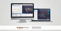
Trace Software International to Launch elec calc BIM
With 30 years of experience, Trace Software International, a leading company in the creation of design software solutions for the electrical engineering, is thrilled to announce that will launch elec calc™ BIM – a real game changer within the industry. Building Information Modelling (BIM) is here to stay, ready to disrupt old ways of doing things within the building industry. Previously, the design process in the construction industry - relied on multi-stage issuing of drawings - was characte...

Vectorworks 2018 Now Available in Spanish
Columbia, MD — Global design and BIM software developer Vectorworks, Inc. has released the Spanish version of its Vectorworks 2018 product line, which includes Vectorworks® Architect, Landmark, Spotlight, Designer and Fundamentals. New this year is Braceworks™, a structural load analysis add-on module targeted to designers and riggers working on temporary structures. The Spanish version follows the English version, released this past September, and joins the additional language versions of the p...
WinCan’s ESRI ArcGIS Integration Brings Enhanced GIS Capabilities to Sewer Inspection
PITTSBURGH, PA —When integrated with ESRI’s ArcGIS platform, WinCan VX sewer assessment software allows users to navigate and analyze inspection data using a rich GIS (geographic information system) interface. With it, users can click map features to link to section and defect information, or they can click a tabular record in an inspection to jump immediately to its mapped location. With this bidirectional link between GIS and WinCan, inspections can be pre-populated with data residing in GIS (...

FARO Leads in Virtual Reality for Construction, Design and Forensics
Lake Mary, FL - FARO® (NASDAQ: FARO), the world’s most trusted source for product design, construction BIM/CIM, and public safety forensics announces the release of Virtual Reality (VR)-ready FARO® SCENE 7.1 software (http://www.faro.com/scene/sg). FARO SCENE 7.1 enables an immersive VR experience with integration of detailed photographic textures, i.e., surface details of an object and rendering of 3D scan data so quickly that it appears to be generated in real time. A free 30-day trial...

Autodesk Powers the Future of Manufacturing and Construction with Forge
At Autodesk University, Autodesk announced that developers and customers of all sizes are adopting its Forge developer platform to build and deploy apps and services to drive the future of making things in manufacturing and construction. A new platform update has also been launched to make building on Forge even easier. Next-generation cloud application framework The design and engineering world is undergoing a major disruption from a single-user, file-based, desktop CAD experience to a de...

Sulzer Announces MIXPAC MixCoat Manual Protective Coating Dispensing System
Sulzer Mixpac USA, Inc., the leading innovator of 2-component adhesive dispensing systems, announces the availability of MIXPAC™ MixCoat™ Manual, a member of the innovative MIXPAC™ MixCoat™ cartridge-based 2-component dispensing system family. The MixCoat Manual protective coating dispensing system features a lightweight design with a unique brush assembly on a manual dispenser, which greatly increases stripe coating productivity and speed. The MixCoat Manual system is ideal for repairs and rope...
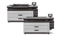
HP Introduces Faster PageWide XL Printers for Enhanced Technical Production
LAS VEGAS, Nev. — Today at Autodesk University, HP Inc. announced new HP PageWide XL printers with sharp, up to 70 percent faster1 output, enabling technical production providers to grow AEC volume and expand business in color applications with the market-leading HP PageWide XL printer portfolio. The new HP PageWide XL 5100 and HP PageWide XL 6000 printers and multifunction printers strengthen the fastest printer portfolio in the market2 to equip enterprise print rooms, central reprographic d...
Esri Collaborates with Mobileye to Bring Real-Time Sensor Data to Public Transit
REDLANDS, Calif.— Esri, the global leader in spatial analytics, today announced a collaboration with Mobileye, an Intel Company and a leading provider of advanced driver-assistance systems software, to integrate Esri mapping, analysis, and visualization with Mobileye’s Shield+™ product. This collaboration will provide cities with the ability to visualize and analyze real-time location data from Shield+, improving safety for all road users in urban environments. Mobileye’s Shield+ will stream...

New Laser Scanner Offers Up to 1 Km Long Range Scanning Capability
(Heerbrugg, Switzerland) – Leica Geosystems, industry leader of measurement technology, announced today the Leica ScanStation P50, the fastest and safest long-range 3D laser scanner, as the newest member of the 3D terrestrial laser scanner P-Series. The new ScanStation P50 combines all the well-known features of the P40 plus a longer-range scanning capability of more than 1 kilometre. Increasing users’ flexibility to offer services in new markets, this rugged and versatile laser scanner enabl...
Stormwater Interview with Robert Page, P.E., Vice President, HNTB

TriMet’s Banfield Type 1 Substation Replacement Project

February Issue 2026
