
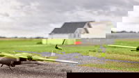
How Machine Control Helps Construction Professionals Regain Control of Project Accuracy and Waste
By: Association of Equipment Manufacturers (AEM) staff MILWAUKEE – AEM’s new report, Benefits of Construction Technologies and their Impact on Society, details how four key innovations are helping construction sites become safer and more productive, while also reducing their environmental footprint. One of those technologies, machine control, is changing the way earthmoving and paving tasks are completed. Previously unimaginable levels of accuracy and efficiency are being achieved, resulti...
Phase One, Quantum Systems and Trimble Unveil Groundbreaking Survey Grade UAV Solution with Phase One P5 Camera Launch
LAS VEGAS, NV, USA - Trimble Dimensions -- Phase One, pioneer in medium- and large-format digital cameras and imaging systems proudly announces the next-generation instrument for the modern surveyor in collaboration with Quantum Systems and Trimble. The new state-of-the-art Phase One P5 128-megapixel camera, purpose-built for survey grade applications, has been seamlessly integrated into Quantum Systems' flagship Trinity Pro mapping drone and the leading surveying workflow Trimble Business Cente...

WSP Upgrades Capabilities to Offer Advanced Geospatial LiDAR Services
State-of-the-art vehicle paired with mobile system developed by Riegl features high-performance dual head scanners and high-resolution cameras in an inclusive mobile mapping system for accurate and rich data collection at highway speeds. MOORESVILLE, NORTH CAROLINA — WSP, a leading engineering, environment and professional services consultancy, has upgraded its surveying capabilities with an industry-leading mobile light detection and ranging (LiDAR) system following its re...

8 Tech Companies Selected to Partner with NYC Department of Environmental Protection in Inaugural Environmental Tech Lab
Public-private initiative will leverage global tech sector to help meet regional climate resilience goals Today the Environmental Tech Lab (ETL) announced that eight companies have been selected to collaborate with the New York City Department of Environmental Protection (DEP) to test technologies designed to enhance operational efficiency and data utilization at the nation’s largest municipal water and wastewater utility. The ETL, launched earlier this year by DEP and Partnership Fund f...
Avvir Announces New Product Features for Construction Professionals
Enhancements designed to improve reporting and prevent project delays New York, NY | November 01, 2023 - Avvir, an automated risk analysis company for the construction industry, today announced a suite of new product enhancements including Clash Results, User Generated Inspect Reports, Project Metrics, and more, all designed to enable construction teams to simplify reporting and quickly identify potential issues to prevent errors and delays in the construction process. Additional product...

one.network to Create Lane Closure Notification System Pilot for Central Florida Expressway Authority
one.network will provide CFX with a single software platform to plan, manage and share all network lane closure information with employees, contractors and the public. ORLANDO, Florida – one.network, a leading road management and work zone data technology provider, today announced the company will be working with the Central Florida Expressway Authority (CFX) to create a Lane Closure Notification System (LCNS) pilot project for the area’s toll roads. CFX’s roads include some of the world’s...
ProjectReady Now Automates Procore Site Creation
Automated Creation and Connection of Procore Project Sites In ProjectReady Streamlines New Project Setup and Removes Administrative Overhead WHITE PLAINS, NY — October 26, 2023 – ProjectReady, a leading provider of collaborative project information management software for Architecture, Engineering, and Construction (AEC) projects today announced a new automated site setup feature marking a significant milestone within its involvement on the Procore App Marketplace. Procore Technologies, Inc. is...
Siemens’ Company Enlighted Adds Powerful New AI Capabilities for IoT in Buildings
- Siemens’ company Enlighted releases new analytics for more efficient building operations, and announces expanded partner ecosystem - Enlighted achieves higher asset tracking accuracy by introducing artificial intelligence to Real-Time Location System (RTLS) - Solutions are part of the Siemens Xcelerator Marketplace Enlighted, a leading property technology company owned by Siemens, has announced the expanded use of artificial intelligence (AI) in its Location Services solution,...
Murphy Geospatial expand services to celebrate 40th anniversary
Geospatial leader Murphy Geospatial, is launching a bespoke mobile-mapping technology to support faster and more accurate geospatial data capture in the built environment. The eye-catching vehicle, called GeoDrive, can easily capture up to 100km of geospatial survey data in just one day. In a world where the sustainability and maintenance of infrastructure assets are of utmost importance, Murphy Geospatial plays a crucial role by providing accurate geospatial data. This data empowers asset ow...

A compact underwater robot providing a safer alternative for underwater inspection, search and maintenance
Professional divers and the Tethys ROV after an underwater inspection operation. Divers can face difficult and dangerous conditions when performing essential underwater inspection, search and maintenance. Now a new Remotely Operated Vehicle (ROV) from Switzerland’s Tethys Robotics is providing a much safer alternative. Find out how a Nortek DVL is being used to complete the navigation solution for this compact robot, while maintaining navigational accuracy in the most challenging un...
Stormwater Interview with Robert Page, P.E., Vice President, HNTB

TriMet’s Banfield Type 1 Substation Replacement Project

February Issue 2026
