
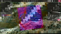
Esri Integrates with Microsoft Fabric to Deliver Leading Spatial Analytics Capabilities
Esri’s Interactive Mapping and Data Exploration Delivers 140 Spatial Analytics Tools and Functions into the Fabric User Experience REDLANDS, Calif.— To meet the growing demand for spatial analytics, Esri is extending its long-standing strategic collaboration with Microsoft through a unified analytics platform powered by spatial capabilities. Microsoft Fabric, now in General Availability as announced today at Microsoft Ignite, will accelerate time to insights and reveal unexplored patterns, tr...
Esri Advances ArcGIS Platform
Enhancements to Esri’s Platform as a Service Will Help Developers and Businesses More Efficiently and Securely Build Solutions REDLANDS, Calif.— In 2021, Esri, the global leader in location intelligence, released ArcGIS Platform, a geospatial platform as a service (PaaS) for developers to integrate location capabilities into their apps, business systems, and products. Now, the company is adding two new enhanced services to ArcGIS Platform to improve the ease, speed, cost effectiveness, and se...

Introducing Autodesk AI for Design and Make
LAS VEGAS, Nov. 13, 2023 – AUTODESK UNIVERSITY –Autodesk, Inc. (NASDAQ: ADSK) today announced Autodesk AI, technology that unlocks creativity, helps solve problems, and eliminates non-productive work across the industries that design and make the world around us. Available in Autodesk products and native to its Design and Make Platform, Autodesk AI provides intelligent assistance and generative capabilities that allow customers to imagine and explore freely while producing precise, accurate, and...
Esri’s ArcGIS Basemaps and ArcGIS Living Atlas Data to Be Integrated into Autodesk Software Environment
AEC Professionals Will Have Access to Esri’s Rich, Authoritative Geospatial Reference Data with Autodesk Product Suite REDLANDS, Calif. — Digital transformation is rapidly changing the foundational processes powering the architecture, engineering, and construction (AEC) sectors. Industry leaders are relying on the interoperability of geographic information systems (GIS) and building information modeling (BIM) to reduce costs and boost efficiency across construction projects. In support of the...
Introducing Felt 2.0: The Most Powerful Tool for Professional Map Making
With spatial analysis and web-based collaboration, Felt makes maps easier and more accessible to organizations, empowers better decision-making for GIS professionals November 13, 2023--OAKLAND, Calif.-- Felt, the world’s first collaborative mapping tool, today launched Felt 2.0 with powerful data transformation tools that enhance its intuitive and professional platform. Now with spatial analysis features, users can manipulate and analyze geographic data, making it easier to unite and ext...

Lenovo Unleashes Performance with ThinkStation P8 Powered by AMD Ryzen Threadripper PRO 7000 WX-Series Processors and NVIDIA RTX Graphics Cards
November 13, 2023 – Today, Lenovo™ announced the new ThinkStation™ P8 tower workstation powered by AMD Ryzen™ Threadripper™ PRO 7000 WX-Series processors and NVIDIA® RTX™ GPUs. Designed to deliver unparalleled performance, reliability and flexibility for professionals who demand the best from their workstations, the bold new ThinkStation P8 builds on the success of the award-winning P620, the world’s first workstation powered by AMD Ryzen Threadripper PRO processors. Featuring an optimized therm...
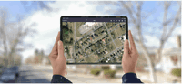
EarthCam Premieres Live Camera Integration with Esri ArcGIS Online
Live streams have many important geospatial use-cases - climate change, crime, active construction and more Live views enable visual verification within Geographical Information Systems (GIS) LAS VEGAS – EarthCam, the leader in live camera technology, content and services, today announced its integration with Esri® ArcGIS Online®, the popular Geographical Information Systems (GIS) platform, at Autodesk University. EarthCam’s live camera views deliver a new level of location intelligen...
Introducing vSite: The Geospatial Digital Twin Transforming Construction Sites
Toronto, November 13, 2023 – Today marks a significant leap forward in connected construction as vGIS unveils vSite, an innovative AR & AI-powered digital twin designed to revolutionize how construction sites are managed and completed. By integrating a geospatial hub, advanced visualization, and site-specific augmented reality, vSite provides an unparalleled solution for project teams working on infrastructure projects to solve many of the site communication and collaboration challenges that lea...
New OverIT Field Service Management Capabilities Streamline Operations
Mobile GIS redlining capability takes field service management software to a new level (Boston, USA) – OverIT, a leading provider of Field Service Management (FSM) software solutions, has added mobile redlining GIS capability to its industry leading platform to enable field technicians to work more quickly, accurately, and safely. According to Daniel Goldstein, SVP of Product Management, mobile GIS redlining capability is the latest step forward on the road to transforming the way fie...

Trimble Introduces Next Generation MPS566 Modular GNSS Heading Receiver
Trimble announced today its next generation Global Navigation Satellite System (GNSS) receiver for marine construction and drilling and piling operations—the Trimble MPS566 Modular GNSS heading receiver. With built-in dual GNSS antenna ports and constellation-agnostic Trimble ProPoint™ technology, the MPS566 delivers highly accurate positions and orientation for work that demands precise heading. With a ruggedized and compact form factor, the MPS566 consumes low power and has minimal cabling, al...
Stormwater Interview with Robert Page, P.E., Vice President, HNTB

TriMet’s Banfield Type 1 Substation Replacement Project

February Issue 2026
