
BlueConduit launches LSL Replacements tool to streamline lead service line replacement planning
New Esri-integrated software enables data-driven prioritization, planning, and tracking in compliance with the Lead and Copper Rule Improvements (LCRI) Ann Arbor, MI — BlueConduit, the leading provider of digital solutions for the water industry, today announced the launch of its latest software solution: Lead Service Line (LSL) Replacements. This powerful new tool builds on the company’s data science expertise and empowers utilities and engineering firms to create optimized, data-driven LSL...

Coastal Technologies Corporation Secures Groundbreaking Patent for Coastal Protection and Environmental Resilience Technologies
Long Island, New York — Coastal Technologies Corporation (Coastal), a global leader in innovative environmental protection solutions, proudly announces that the United States Patent and Trademark Office has awarded the company a comprehensive utility patent. This milestone positions Coastal at the forefront of developing technologies designed to safeguard and restore coastlines, ecosystems, and vulnerable infrastructure facing an array of environmental threats, including erosion, landslides, ris...

Researchers from Incheon National University Propose Novel Approaches for Improved Microgrid Management
"Rural electricity" by kevin dooley A new optimization model improves microgrid operation, enhancing energy efficiency and ensuring reliable power supply Scientists at Incheon National University have developed a new optimization model to improve microgrid operation. This model adapts to unexpected changes in power supply and demand, ensuring stable and efficient energy systems. By addressing challenges like power outages and varying energy needs, this approach enhances the reli...

Teledyne Geospatial to showcase extensive range of lidar solutions at Geo Week
Vaughan, Ontario, CANADA – January 28, 2025 — Teledyne Geospatial will display their newest solutions for land survey, coastal mapping and electric inspection at Geo Week, February 10-12, 2025, in Denver, CO, USA. Discover how Teledyne's seamless integration of hardware and software accelerates workflows and generates insights in real-time. Join us at booth #1227 on Monday at 3 p.m. for the official launch of Fathom, the world’s fastest and most intuitive airborne coastal mapping solution. The...

Zevtron Announces Support for Locations Transitioning from Shell Recharge EV Solution
Carlsbad, CA – Zevtron, a leading provider of innovative EV charging solutions, is proud to announce its support for locations currently utilizing the Shell Recharge EV system, as Shell prepares to discontinue its Shell Sky software on April 30, 2025 for third-party commercial EV chargers in the United States and Canada. With a proven white-label platform that seamlessly integrates into existing OCPP compatible charging hardware, Zevtron is stepping in to ensure a smooth and uninterrupted transi...
Kuwait Environment Public Authority Transforms Violation Management with Intalio's Advanced Inspection System
KUWAIT CITY, Kuwait, Jan. 22, 2025 /PRNewswire/ -- Intalio, a global leader in Intelligent Information Management, has partnered with the Kuwait Environment Public Authority (EPA) to transform how the EPA manages environmental violations. With a custom-built electronic violations system, the EPA now automates the recording, processing, and reconciliation of violation data, significantly improving compliance efforts. The project started on June 30, 2022, and was successfully completed on March 31...

EagleView Launches New Property Data Ecosystem
Now customers across property finance, real estate, insurance, roofing, solar, infrastructure management and more can access an unrivaled offering of property asset intelligence to make better business decisions. January 22, 2025 – Rochester, NY – EagleView, a leading provider of aerial imagery, announces the launch of its new property data ecosystem. The ecosystem has over 60 petabytes of asset data derived from high-definition aerial imagery. EagleView’s property data ecosystem includes r...
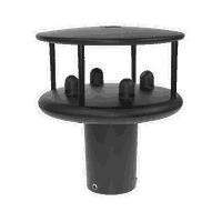
Market leading WindSonic 2-axis wind sensors now easier to integrate into more systems
Lymington, 16 January 2025 – Gill Instruments, announced today an update to its market-leading WindSonic 2-axis wind sensors, WindSonic and WindSonic 75 both now have Modbus output alongside existing output options. Renowned for their accuracy and reliability, the WindSonic 2-axis anemometers are used extensively in applications that require integration into larger management and control systems across industries such as construction, renewable energy, manufacturing, and environmental monitor...

The AI Revolution in 3D Rendering: Key Insights for Architects and Designers
The AI Revolution in 3D Rendering: Key Insights for Architects and Designers Artificial intelligence is no longer a futuristic concept in the architectural, engineering, and construction (AEC) industry—it’s already transforming how designers work. AI-powered tools streamline workflows, boost creativity, and redefine architectural visualization. Architects and designers now use AI to conceptualize ideas more quickly, optimize materials, and refine real-time rendering with remarkable efficiency...

Nemetschek Group unveils AI Assistant at BAU 2025
MUNICH, January 15, 2025 – The Nemetschek Group, a leading software provider for the AEC/O and media industries, today unveiled a preview of the AI Assistant, the Group's first AI-agent-based technology, for Archicad. Introduced at Munich’s BAU 2025, the leading trade fair for architecture, materials, and systems, the AI Assistant streamlines creative exploration while saving time and ensuring quality and compliance. The AI Assistant will be embedded directly into Archicad as an integrated AI...
Stormwater Interview with Robert Page, P.E., Vice President, HNTB

TriMet’s Banfield Type 1 Substation Replacement Project

February Issue 2026
