
Bentley Systems and Topcon Positioning Systems Launch their Digital Construction Works Joint Venture, to Close the Constructioneering Advancement Gap
New global company introduces digital integration services, advancing constructors’ innovative digital workflows SINGAPORE — The Year in Infrastructure Conference — Bentley Systems, the leading global provider of comprehensive software and digital twin cloud services for advancing the design, construction, and operations of infrastructure, and Topcon Positioning Systems, a world leader in positioning technology for the survey and construction industries, today announced that its new, joi...
GSSI Announces the GS Series GPR Product Line for Geophysical and Environmental Surveys
GSSI, the world’s leading manufacturer of ground penetrating radar (GPR) equipment, introduces the new 200 MHz (200 HS) antenna, the first of the next-generation high-performance GS Series, designed for applications that require deeper depth penetration. The new 200 HS antenna serves as the foundation for the GS Series, which is ideal for geophysical, geotechnical, or environmental applications that require high reliability under challenging survey conditions. The newly designed 200 HS antenn...

Bluefin Technology Partners Develops Fluent with Walchem
Worcester Tech Company Builds Remote Monitoring System for Water Testing Devices Worcester, MA – Bluefin Technology Partners, one of Massachusetts’ most innovative digital product developers, today announced their partnership with the water treatment technology and equipment company, Walchem. Bluefin worked with Walchem to develop Fluent, a remote monitoring and reporting system which is fully synchronized with Walchem’s web based controllers, allowing for simple, fast and remote communicati...

FLIR Launches Industry-First Deep Learning-Enabled Machine Vision Camera: Firefly DL
ARLINGTON, Va. – FLIR Systems, Inc. (NASDAQ: FLIR) today announced the launch of the FLIR Firefly® DL, the industry’s first deep learning, inference-enabled machine vision camera with FLIR Neuro technology. With its small size, low weight, minimal power consumption, and deep learning capabilities, the FLIR Firefly DL camera is ideal for embedding into mobile, desktop, and handheld systems. The Firefly DL with deep learning enables original equipment manufacturers, engineers, and makers to qui...

Microdesk Launches ARID™, the First Cloud-based Asset Registry and Information Database Application for Enhanced Asset Data Management
New York, NY - Global AECO consulting firm Microdesk, announced today its launch of ARID™, a Cloud- based Asset Registry and Information Database application that leverages machine learning (ML) and artificial intelligence (AI) for enhanced asset data management. ARID™ allows organizations to capture and organize equipment assets in a central location and uses ML and AI to analyze assets names and values, identify inconsistencies and make recommendations based on industry standards. ARID™ is...

Concept3D’s New 3D Panorama Feature Simplifies Space Planning
Concept3D, a leader in creating immersive online experiences with 3D modeling, interactive maps and virtual tour software, today announced the launch of its new 3D Panorama feature, which integrates into the Concept3D interactive map and virtual tour platform. Hundreds of higher education institutions, convention centers, hotels, hospitals and businesses use the Concept3D platform to bring their space into the digital world and make it interactive for marketing, wayfinding, guest experience and...

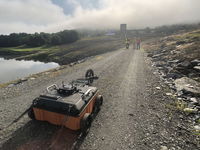
Dynamic Infrastructure implements deep AI technology to prevent bridges and tunnels from collapsing
The New York and Tel Aviv based startup Dynamic Infrastructure is implementing the world's first deep-learning solution which allows bridge and tunnel owners and operators to obtain visual diagnosis of the assets they manage. The system provides live, cloud-based, 3D views of the bridge or tunnel and automatically alerts when changes are detected in maintenance and operation conditions - before the issues evolve into large-scale failures. With huge Opex and Capex positive impact, Dynamic Infras...

CareConnect Selects Woolpert to Integrate, Manage Google Maps Platform Enterprise Account
The expanding software solution provider will leverage the platform to increase compliance and operational efficiencies for its clients and customers. DAYTON, Ohio (Oct. 14, 2019) — Woolpert was recently chosen by CareConnect, a software-as-a-service-based (SaaS) technology provider for the home care market, to integrate and manage its Google Maps Platform Enterprise Account. CareConnect plans to leverage this platform to optimize the compliance, automated shift booking, communications and lo...
Wingtra Launches Corridor Mapping with its 1.10 Release
The new corridor mapping feature in the latest (1.10) Wingtra software release enables fast, efficient coverage of long, narrow stretches with either of WingtraOne’s RX1R II or QX1 payloads. With the touch of a few buttons, customers can now enjoy the broad coverage and vertical take-off and landing (VTOL) operational flexibility that WingtraOne is known for when running large, linear plans. Wingtra corridor drone mapping features bring a new level of efficiency, as well as high accuracy and...
Autodesk Unveils Robust New Features for BIM 360
SAN RAFAEL, Calif. - Autodesk, Inc. (NASDAQ: ADSK) today announced enhancements to BIM 360, including a newly designed Layout app for mobile devices on Android operating systems. Autodesk also unveiled new BIM 360 features that make the project set-up process easier and increase collaboration between the field and the office, with expanded machine learning capabilities to better identify risk. Traditionally, construction layout and verification tasks were handled by one or two trained individ...
Stormwater Interview with Robert Page, P.E., Vice President, HNTB

TriMet’s Banfield Type 1 Substation Replacement Project

February Issue 2026
