
Stantec GenerationAV™ partners with Swiftmile to advance micromobility and create AV-ready streets
Micromobility Hubs will keep light electric vehicles orderly and charged while serving as a platform for autonomous and connected vehicle technology EDMONTON, AB - TSX, NYSE:STN: Stantec GenerationAV™ and Swiftmile have entered into a partnership to bring Swiftmile’s Micromobility Hubs to cities, municipalities, and campuses, helping scale adoption of electric micromobility while providing a new platform for integrating AV and connected vehicle technology. The partnership addresses...

Three New Cloud Collaboration Solutions to Connect Design Teams: Better Business Outcomes, Improved Resiliency
Today we release three significant updates to our architecture, engineering and construction (AEC) design customers: Autodesk Docs is included in the AEC Collection, BIM 360 Design is now Autodesk BIM Collaborate Pro and Autodesk BIM Collaborate is available globally. Amy Bunszel first announced these cloud offerings for AEC design workflows at Autodesk University 2020, and we’re pleased to make them available today. Our customers’ needs are constantly evolving, which is more evident today th...

Aldar Properties, leading real estate developer in the Middle East, to use Asite on all future projects
Asite’s construction cloud platform will streamline project information and enhance collaboration across the full lifecycle of Aldar’s assets Abu Dhabi, UAE (February 2021) – Aldar Properties, the leading real estate developer in Abu Dhabi, most known for its iconic developments, will utilize Asite’s cloud-based platform on a magnitude of innovative and exciting projects. These projects encompass a range of sectors, including Residential, Retail, Commercial and Hospitality & Leisure....

FleetWatcher’s Electronic Ticketing Eliminates Points of Contact so Drivers Can Maintain Social Distancing
Indianapolis, IN) – Earthwave’s FleetWatcher Electronic Ticketing, or E-ticketing, helps drivers maintain social distancing by eliminating points of contact and ticket transfers inherent with paper ticketing programs. E-ticketing is an electronic means of producing individual scale tickets and providing material haul summaries for state-funded roadway projects. In addition to eliminating human points of contact, e-ticketing enhances efficiencies with accurate and timely reporting, and scale ti...

Earthwave FleetWatcher Materials Management Solution (MMS) Slashes Trucking Costs by Curbing Inefficiencies
(Indianapolis, IN) – Earthwave’s FleetWatcher Materials Management Solution (MMS), a wireless telematics system developed specifically for paving contractors, helps to slash trucking costs by drastically curtailing inefficiencies. With Load Cycle Analysis users can identify problems such as trucks waiting at the plant or at a paver and correct them in real-time. In addition to eliminating trucks travelling together, hiding behind RAP piles, and long lines at the plant or paver, users can see w...
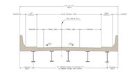
Free eSPAN140 Steel Bridge Design Tool Updated With New Features
Bridge professionals can save additional time and costs on short span projects WASHINGTON D.C. – The Short Span Steel Bridge Alliance (SSSBA) has updated its web-based steel bridge preliminary design tool, eSPAN140, with new features. eSPAN140 is a free-to-use tool that provides bridge professionals with an all-in-one resource to design rolled beam, plate girder, press-brake tub girder, and buried soil structures up to 140 feet in length. Minimal user inputs result in optimized, individualiz...

Trimble Introduces the Next Generation of 3D Paving Control for Asphalt Pavers
Trimble Roadworks Advances Asphalt Paving Control with Intuitive Software, Rugged Hardware and Office-to-Field Interconnectivity SUNNYVALE, Calif.— Trimble (NASDAQ:TRMB) introduced today the Trimble® Roadworks 3D Paving Control Platform for Asphalt Pavers, the next-generation platform for 3D asphalt paving control systems. Trimble Roadworks is a highly accurate, automatic 3D screed control system that can significantly improve paving productivity and rideability by directly referencing the d...

Esri Releases ArcGIS Velocity for Analysis of Real-Time IoT Data
Additional License Levels Open Opportunities for New Industries to Integrate Geospatial Sensor Capability REDLANDS, Calif.— Esri, the global leader in location intelligence, today announced the release of ArcGIS Velocity. Previously known as ArcGIS Analytics for IoT, Velocity is a new cloud-native capability for ingestion, processing, visualization, and analysis of real-time and high-volume geospatial data on the fly. It complements existing systems with geographic information system (GI...

New eBee Geo joins senseFly line of professional fixed-wing mapping drones
CHESEAUX-SUR-LAUSANNE, Switzerland, 01 February 2021 – senseFly, the global leader in fixed-wing mapping drones, today announces the expansion of its flagship eBee X drone solution with the launch of eBee Geo. The eBee Geo represents the first extension into a new eBee X series of fixed-wing drones and is positioned as a cost-effective option for surveyors and GIS professionals who may be unfamiliar with fixed-wing drone mapping and data collection. With a maximum 45-minute flight time, the...
PointFuse Innovates Construction Workflows for Shockey
PointFuse Laser Scanning Software Innovates Construction Workflows for Shockey U.S. construction company Howard Shockey & Sons, Inc. has greatly improved construction sequencing and significantly reduced project schedules following the introduction of Pointfuse laser scanning software into its scanning and VDC workflows. Used to convert vast point clouds generated by laser scanners and photogrammetry, Pointfuse creates manageable, intelligent mesh models that automatically classify building...
Stormwater Interview with Robert Page, P.E., Vice President, HNTB

TriMet’s Banfield Type 1 Substation Replacement Project

February Issue 2026
