
GeoMax Releases All-In-One Office Software for Topographical Data
Widnau, SWITZERLAND: GeoMax, professional surveying and construction product provider, announced today the X-PAD Office Fusion, the all-in-one office software combining data from multiple sensors into one easy-to-use interface X-PAD Office Fusion software manages, combines and processes data from GNSS receivers, total stations, laser scanners and other sensors in one single environment whether from GeoMax or any other provider in the market. There is no need to export the data from one progra...

RIEGL Announces Significant Product News at Intergeo 2017
RIEGL launches their newest, innovative Waveform-LiDAR sensors and systems at Intergeo 2017 in Berlin. For terrestrial laser scanning, RIEGL introduced the NEW RIEGL VZ-2000i 3D Laser Scanner. This long range, very high-speed 3D laser scanner captures up to 1.2 million measurements per second, and covers ranges up to 2,500 m, with 5 mm accuracy and 3 mm precision. RIEGL’s unique Waveform-LiDAR technology enables high speed, long range, high accuracy measurements even in poor visibility a...

FLIR Announces C3 Thermal Camera
WILSONVILLE, Ore. – FLIR announced today that the FLIR C3 thermal camera for contractors is now available for purchase. Unveiled earlier this year at the Consumer Electronics Show (CES), the FLIR C3 is a ruggedized, pocket-portable, dedicated thermal camera ideal for home inspectors, real estate professionals, general contractors, and other trade professionals who need a powerful diagnostic tool. With a bright, three-inch touchscreen, the FLIR C3 offers several features that make it a grea...
Trimble Adds Inertial-Based Trolley Solution to its Track Survey and Scanning Rail Portfolio
BERLIN — Trimble (NASDAQ: TRMB) introduced today a new addition to its track survey and scanning rail portfolio—the Trimble® GEDO IMS System. The latest trolley system is lightweight, flexible and fast. It combines an Inertial Measurement Unit (IMU) with scanning and geodetic sensors for surveying railway lines and documenting assets along the track. The announcement was made today at INTERGEO 2017, the world’s largest conference on geodesy, geoinformatics and land management. Th...

Trimble Introduces New Version of eCognition Software Suite with Powerful New Geospatial Data Analysis Capabilities
BERLIN—Trimble (NASDAQ: TRMB) today announced the release of eCognition Suite 9.3, a software platform for advanced geospatial image analysis for environmental, agriculture, forestry and infrastructure applications. Version 9.3 leverages the latest image feature extraction technology to solve challenging problems faster and more accurately for remote sensing specialists, Geographic Information System (GIS) experts, cartographers, photogrammetry and other geospatial professionals. The ann...
Trimble Expands Field-to-Finish Capabilities for Geospatial Professionals with Enhancements to Software Portfolio
BERLIN—Trimble (NASDAQ: TRMB) announced enhancements to its industry leading portfolio of geospatial office software with a new version of Trimble® Business Center and the introduction of Trimble Clarity, a new cloud-based application that enables geospatial professionals to easily visualize and share three-dimensional point cloud data with clients. The new software versions expand the field-to-finish workflows for survey and mapping professionals, providing a complete solution for the delivery...
Trimble Enhances Optical Portfolio with the Next-Generation Mechanical Total Stations
BERLIN—Trimble (NASDAQ: TRMB) today announced the release of the Trimble® C5 and Trimble C3, the next generation of mechanical total stations to support land survey professionals with their cadastral survey, topographic survey and stakeout needs. The new Trimble C-Series mechanical total stations enhance the Trimble portfolio with new productivity boosting features that make everyday field work easier and faster. The announcement was made today at INTERGEO 2017, the world’s largest confe...

FARO Announces Innovative Visual Inspect for Inspection and Design
Lake Mary, FL - FARO® (NASDAQ:FARO), the world’s most trusted source for 3D measurement and imaging solutions for factory metrology, construction BIM/CIM, product design, public safety forensics, and 3D solutions applications, announces the availability of the FARO® Visual Inspect™ product family. This innovative platform enables large, complex 3D CAD (computer-aided design) data to be transferred to an iPad and then used for mobile visualization and comparison to real world conditions (https://...
Applanix Releases Updated Version of POS LVX for High-Accuracy Positioning and Orientation for Autonomous Ground Vehicles
Berlin, Germany – Applanix, a Trimble Company, introduced today an updated version of its POS LVX system, which provides high-accuracy positioning and orientation for the operation of autonomous ground vehicles. The POS LVX can be integrated with cameras, Light Detection and Ranging (LiDAR), RAdio Detection and Ranging (RADAR), and other sensors to provide accurate Positioning and Orientation System Estimation (POSE) for localization, perception, and the production of high-precision maps critic...
Trimble Expands Portfolio of OEM Products for High-AccuracyDirect Georeferencing on Unmanned Aerial Vehicles
BERLIN —Trimble (NASDAQ: TRMB) introduced today three new GNSS-Inertial Systems for Direct Georeferencing on Unmanned Aerial Vehicles (UAVs): the Trimble® APX-15-EI UAV, Trimble APX-18 UAV, and Trimble APX-20 UAV. Direct Georeferencing with the systems allows the location of image elements collected by Light Detection and Ranging (LiDAR) and hyperspectral sensors to be accurately computed without extensive networks of ground control points, reducing costs while maintaining accuracy to produce m...
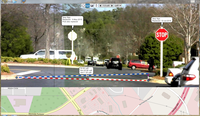
Stormwater Interview with Robert Page, P.E., Vice President, HNTB

TriMet’s Banfield Type 1 Substation Replacement Project

February Issue 2026
