
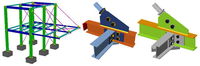
To Help Building and Facilities Managers Meet the Demands of Social Distancing, Bentley Systems Opens Up Full Access to LEGION Simulator and OpenBuildings Station Designer and Waives Subscription Fees through September 30
Simulate People Movement and Test Space Performance to Mitigate Risk in Reopening Public Facilities EXTON, Pa. – Bentley Systems, Incorporated, a leading global provider of comprehensive software and digital twins services for advancing the design, construction, and operations of infrastructure, today announced it has opened up its LEGION Simulator and OpenBuildings Station Designer software, including waiving new subscription fees through September 30, 2020, for facilities managers to...
Emesent releases Colourisation for Hovermap, bringing a new level of reality capture to 3D Point Clouds
BRISBANE, Australia - Global technology company Emesent today announced the release of the Colourisation functionality for its Hovermap LiDAR scanner. The 3D point clouds from Hovermap can now be augmented with true colour, providing additional context for visualisation and analysis. "We’re excited to announce this significant new feature for Emesent," said Emesent's CEO and Co-Founder Stefan Hrabar. "Colourisation provides greater insights for our customers across many industries. This...
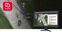
Leica Geosystems announces latest version of public safety software
Leica Map360 v4.0 introduces three editions to digitize and document any crash or crime scene (HEERBRUGG, Switzerland) – Leica Geosystems, a Hexagon company, announced today the latest version of Leica Map360 crash and crime scene diagramming and reconstruction software, bringing three editions to meet specific customer needs based on the technology used to measure and collect any scene. With an entirely new user experience (UX) and interface, Map360 v4.0 simplifies incident reconstru...
DigEplan Announces New Partnership with Cityworks to Deliver Fully Integrated Electronic Plan Review for Vital Government Services
DigEplan, a global leader in fully integrated electronic plan review, announces a new partnership with Cityworks, the leading GIS-centric solution for public asset management, to bring city and county government permitting departments an end-to-end, fully integrated electronic plan review that is aligned with today’s public sector budgets. Deployed in days, DigEplan and Cityworks are enabling vital government services to continue, providing business continuity whilst adhering to Covid-19 rules....
Woolpert Designs Cityworks GeoPhoto Tool to Improve Work Order Management
The tool layers the technology of Esri and the functionality of Cityworks to spatially represent linear assets. RICHMOND, Va. — Woolpert has designed the Cityworks GeoPhoto Tool to enable field crews and end users to spatially view linear assets and relevant work order information at the exact location along each asset. The tool leverages the GIS capabilities of Esri with Cityworks asset management software functionality and allows work orders to be started, accessed and completed from the f...
Released! IDEA StatiCa 20 is here
The new version of IDEA StatiCa is here! It is the biggest implementation of customer feedback and wishes we have had in years. And that means something – IDEA StatiCa is used by over 3500 customers and 10.000 users who share more than 4000 unique IDEA StatiCa projects every month. Highlights from Steel release notes 110 new connection templates added to the starting wizard Section model view – drawings Steel-to-timber connections Hong Kong Code (HKG) & Indian Standard Code (...

IMAGINiT Technologies Becomes Epic Games Reseller for Twinmotion Real-time Immersive Visualization Tools
BALTIMORE, MD — Committed to providing best-in-class products and services to architects, engineers, and designers, IMAGINiT Technologies today announces that it has become Epic Games’ first partner to offer the popular Twinmotion software in the United States and Canada. Twinmotion’s 3D visualization technology allows architecture, construction, urban planning, and other building professionals, to share designs that have been created using many of today’s design tools. “To build a strong fo...

MALA MIRA HDR - 3D GPR AT ITS BEST
MALA GPR Australia is proud to present MALÅ MIRA HDR, the new GPR array system. It’s the professional choice for large scale 3D GPR mapping and will help customers around the world to create detailed 3D maps of the subsurface with the highest resolution on the market. MALA GPR Australia launches all new MALÅ MIRA HDR, a large area 3D GPR mapping solution with the highest data quality and resolution on the market, highway speed survey capability, improved mechanical design and new user-friendl...

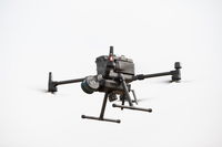
Next Generation of Drone Surveying System Features Now Available from Microdrones
Rome, NY- Fresh off the heels of releasing a new Microdrones as a Service (mdaaS) business model that makes drone surveying and LiDAR accessible to geomatics companies of all sizes, Microdrones announces additional developments that demonstrate a constant commitment to customers. According to Microdrones CEO Vivien Heriard-Dubreuil, “By and large, surveying professionals are still out there getting work done amidst the shutdowns; that’s why we continue to make improvements to our complete system...

CYPE develops software to design, calculate and implement safety measures in spaces in response to COVID-19
The Open BIM COVID-19 program facilitates the adoption and validation of preventive measure to minimise infections and optimise the occupancy of space, both in buildings and open spaces, taking into account aspects such as interpersonal safety distance or furniture The software is translated into 6 languages and can be adapted to the national safety regulations against COVID-19 of any country in the world and at any phase to optimise the distribution of people and prevent the spread of the vi...
Stormwater Interview with Robert Page, P.E., Vice President, HNTB

TriMet’s Banfield Type 1 Substation Replacement Project

February Issue 2026
