Video: Science to Reveal How Long Highway Construction Should Actually Take
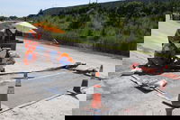
The Indiana Department of Transportation (INDOT) tasked a team of Purdue University engineers with collecting data on concrete maturity through select highway patching and paving projects. The team will use the data to provide a new evidence-based recommendation on the optimal time to open up traffic following a construction project, which would save time and reduce traffic slowdowns. Purdue engineering researchers are collecting data through piezoelectric sensors designed to track concrete s...

Video: State DOTs Leading the Evolution of Drones
In this Transportation TV News Special Report, Building Highways in the Sky: State DOTs Leading the Evolution of Drones learn about a March 2018 survey by the American Association of State Highway and Transportation Officials that shows 35 of 44 responding state departments of transportation (80 percent) are deploying unmanned aircraft systems (UAS), or drones, for a wide range of purposes. The survey finds that 20 state DOTs have incorporated drones into their daily operations. Another 15 state...
Minneapolis' Autonomous Infrastructure: Drones
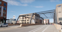
Minnesota is tapping drones to improve safety inspections for its aging bridges.

Tide-Triggered Tremors Give Clues for Earthquake Prediction
The triggering of small, deep earthquakes along California’s San Andreas Fault reveals depth-dependent frictional behavior that may provide insight into patterns signaling when a major quake could be on the horizon, according to a paper released this week by the Proceedings of the National Academy of Sciences (PNAS). The study, which was led by the U.S. Geological Survey and Los Alamos National Laboratory, reports that the deepest part of California’s 800-mile-long San Andreas Fault is weaker...

RIEGL Laser Scanners Used in Forensics and Accident Reconstruction
The use of the RIEGL terrestrial laser scanners, combined with RiSOLVE, is optimized for accident collision investigations. The state of the art hardware and software can be used to rapidly collect evidence at the scene of collisions, which helps to reduce the amount of time roads are closed, reduce lane closures, and minimize road congestion. Data collected from the scanners and processed through the specialized software can be used to produce high quality graphics and detailed plans of collisi...
Augmenting Drone Videos could Facilitate Construction Monitoring
Augmented reality is a fascinating technology that could change the way we live and interact with the world that surrounds us. Unfortunately, we don’t see many good applications of AR in engineering yet, partly because achieving good visual integration of digital objects with reality is very challenging. To display the augmented elements at the right location on a tablet display at every instant, the AR app must know the position of your tablet in real time - that is fundamental to AR. Now th...

Infrastructure Innovation: Developing Creative AEC Solutions with Drones
Drones are one of the technologies most likely to really “take off” and have a significant impact on our industry. Whether referred to as unmanned aerial vehicles (UAVs), unmanned aircraft systems (UASs), remotely piloted aircraft, robots or drones, they’re already changing the way people approach design and construction. The technology offers far more than just a single solution. It’s not just a mini copter with a camera to take aerial images; it’s a platform for solving problems, and many u...
Reality Computing Goes Underground with Ground Penetrating Radar
Ground penetrating radar (GPR) is a non-destructive method for locating and mapping underground objects by transmitting high-frequency radio signals into the ground that bounce back when they hit a buried object or a boundary between different material types. GPR surveys were first used in 1929 to measure the depth of a glacier in Austria and, in the following decades, likewise used to map the thickness of ice sheets and glaciers. In the 1970s, people started to use GPR for applications not invo...
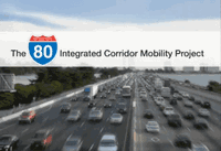
Caltrans Adds Intelligence with the I-80 Integrated Mobility (ICM) Project
The Interstate 80 Integrated Corridor Mobility (ICM) project will bring innovative congestion relief and safety improvements to the I-80 corridor from the Carquinez Bridge to the Bay Bridge. The project is expected to reduce the impacts of both commute and incident-related congestion on the freeway, including long delays and stop-and-go traffic, congestion-related traffic collisions, long emergency response times, unreliable commute times, and cut-through traffic. Project improvements include ad...
As Intelligent Cars Take Off, Regulation Looms
The past four years have brought innovation beyond anything we could have ever imagined, and nowhere have we seen this change more than in our cars. The development of intelligent vehicle technologies is bringing wireless connectivity and the Internet on the go into the mainstream and merging the tech and auto industries. As these two forces converge, our vehicles aren’t just taking us where we want to go, but they tell us how to get there, what we will see when we get there and where to stop al...
Stormwater Interview with Robert Page, P.E., Vice President, HNTB

TriMet’s Banfield Type 1 Substation Replacement Project

February Issue 2026
