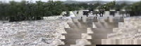
Simpson Strong-Tie Donates $30,000 for Texas Flood Relief
Simpson Strong-Tie has donated $30,000 to the Kerr County Flood Relief Fund following the destructive floods in Texas on July 4, 2025. Kerr County was one of the hardest-hit areas around the Guadalupe River, where the unprecedented flash flooding has tragically claimed at least 120 lives with scores of others injured or missing. Operated by the Community Foundation of the Texas Hill Country, a 501(c)(3) public charity, the Kerr County Flood Relief Fund is supporting relief efforts an...

Exodigo Brings AI Efficiency to Infrastructure Industry, Closes $96 Million Series B
Underground Mapping Innovator Doubles Valuation Based on Global Demand From Utility, Transportation and Infrastructure Leaders as Early Investors Double Down on Oversubscribed Growth Round PALO ALTO, CALIF. and TEL AVIV — July 16, 2025 — Exodigo, the artificial intelligence (AI) and multi-sensing innovator modernizing underground data intelligence, today announced the close of a $96 million Series B round, for a total of $214 million in funding since its launch in2021. Early investors Zee...

Drone Harmony and Pix4D announce strategic partnership to enhance drone mission planning workflows
Lausanne, July 15th, 2025 Drone Harmony, a leading provider of advanced drone mission planning software, and Pix4D, a global leader in photogrammetry and geospatial solutions, are joining forces to deliver a more integrated and efficient experience for drone mapping professionals. This strategic partnership will empower users with an alternative workflow from flight planning to high-quality geospatial outputs. With the growing demand for accuracy, automation, and reliability in drone data...

Eagleview and SkyWatch Announce Alliance to Expand Access to Ultra High-Resolution Aerial Imagery
New collaboration brings Eagleview’s industry-leading imagery to the SkyWatch platform, including Esri’s Content Store for ArcGIS, for single image purchases. San Diego, CA and Rochester, NY – July 15, 2025 – Eagleview, a leading provider of aerial imagery and analytics, and SkyWatch, a leader in remote sensing data technology, today are announcing a new collaboration that makes Eagleview’s ultra high-resolution aerial imagery available across the SkyWatch platform. This new initiative i...

Partnership with Esri gives ArcGIS community easy access to species occurrence records
Software integration aims to increase use and citation of open data on biodiversity among geospatial platform users GBIF and geographic information system (GIS) technology leader Esri have launched a new partnership to facilitate the direct integration of GBIF-mediated biodiversity data with Esri's suite of mapping and analysis software. This first-of-its-kind collaboration aims to improve overall data quality, accessibility and the delivery of open access biodiversity data to Esri...

Esri Collaborates with Microsoft to Bring ArcGIS Users New AI Enhancements
Collaboration Will Integrate Microsoft Azure AI Foundry, Further Democratizing Geospatial Understanding and Workflows REDLANDS, Calif.— Esri, the global leader in geographic information system (GIS) technology, is integrating Microsoft Azure OpenAI Service into ArcGIS. This powerful collaboration equips users with all new AI assistants to simplify work with geospatial data, maps, and analytics. In addition, the AI’s natural language interaction will enable users to quickly understand complex sp...
Esri’s ArcGIS Basemaps Power Dataminr First Alert for Enhanced Real-Time Event Detection and Awareness
New Integration Enables Government Organizations to Better Manage Large-Scale Events, Emergency Response, and More REDLANDS, Calif. — Esri, the global leader in location intelligence, has partnered with Dataminr, the leading real-time AI platform, to enhance real-time emergency response for public organizations. Esri’s ArcGIS Basemaps will be integrated into Dataminr First Alert, a real-time critical event discovery solution. Used by public sector organizations around the globe for emergency a...

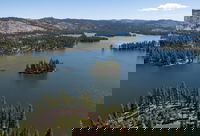
Fugro and Esri collaborate to advance climate resilience
Image credit: EOMAP - a Fugro company Fugro has entered into a strategic collaboration with Esri, the global leader in geographic information system (GIS) software, to provide integrated geospatial solutions that empower climate resilience decision-making and sustainable development. Initially, the joint effort will focus on tackling the environmental challenges of Small Island Developing States (SIDS), starting with SIDS in the Caribbean. Nearly 22 million people in SIDS live l...

Meridiam and Aberdeen, Together as Golden Link Concessionaire, Celebrate 10 Years of The Presidio Parkway with Caltrans and San Francisco County Transportation Authority
he anniversary commemorates the delivery, opening, and first decade of successful operation of the Presidio Parkway SAN FRANCISCO – Today, Meridiam and Aberdeen, together as Golden Link Concessionaire (GLC), proudly celebrate the 10th anniversary of the opening of the Presidio Parkway in San Francisco, California alongside its Project Sponsors the California Department of Transportation (Caltrans) and the San Francisco County Transportation Authority (SFCTA). The 1.6-mile-long parkway, con...
Stantec selected to support California Water Plan
California Water Plan Update 2028 will serve as the state’s strategic roadmap in a changing climate SACRAMENTO, CA: TSX, NYSE: STN: Stantec, a global leader in sustainable design and engineering, has been selected by the California Department of Water Resources (DWR) to provide water resource planning and facilitation services to support the California Water Plan Update 2028, a document that serves as the state’s roadmap to set water management priorities in a changing climate. First...
Stormwater Interview with Robert Page, P.E., Vice President, HNTB

TriMet’s Banfield Type 1 Substation Replacement Project

February Issue 2026
